
IFR In-Field Referencing
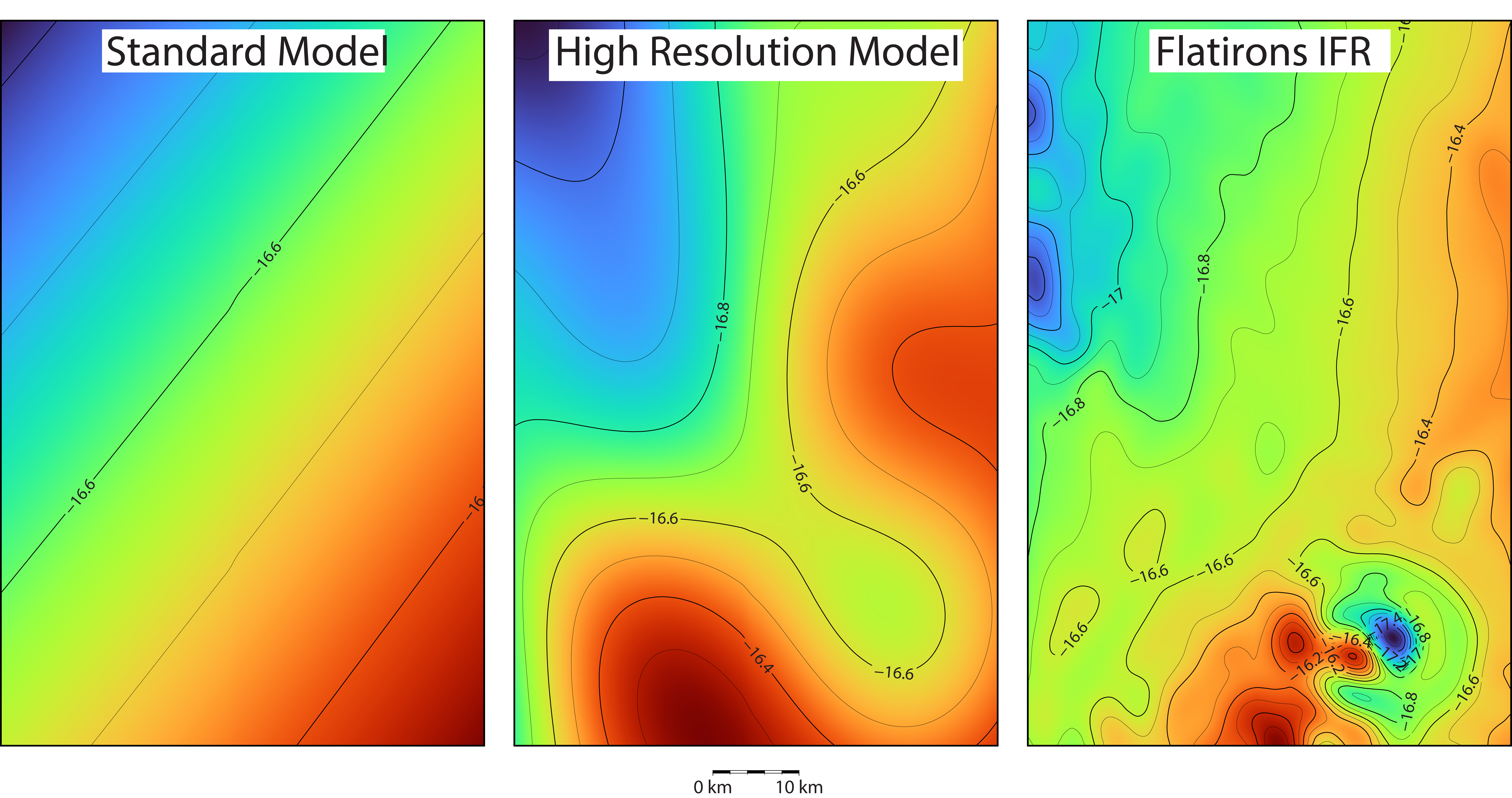
In-Field Referencing (IFR) is the determination of magnetic field values (typically declination, dip angle, and total field) in three dimensions in an oil field region, in order to support measurement while drilling (MWD) operations. Flatirons Geomagnetic Services combines high-quality space-based measurements from satellites with local survey measurements taken by aircraft and ships to build state-of-the-art magnetic field models of the crustal anomalies in the region of interest. Our methodology allows us to model both regular and irregularly shaped surveys, as well as handle any type of local terrain.
Additionally, our IFR modeling can handle extremely high resolution requirements and can provide accurate estimates of errors. Flatirons’s accurate 3D modeling of the geomagnetic field improves well placement by reducing ellipses of positional uncertainty. Flatirons IFR models are provided as 3D grids of the magnetic declination, dip and total field. Flatirons IFR is available globally. Flatirons IFR models have been successfully employed in the oil fields of North America and South America. Validation studies by our industry partners against MWD surveys have confirmed the high accuracy of our IFR solutions
Why Flatirons In-Field Referencing
- Ability to ingest airborne, ship, and satellite measurements into a single model
- 3D model of the subsurface geomagnetic field which includes the entire wavelength spectrum of the geomagnetic field
- Includes software which allows drillers to compute the declination, dip and total field along any well trajectory
- FGS IFR solutions have been successfully used in numerous locations around the world, and have been successfully validated against down-hole MWD measurements.